
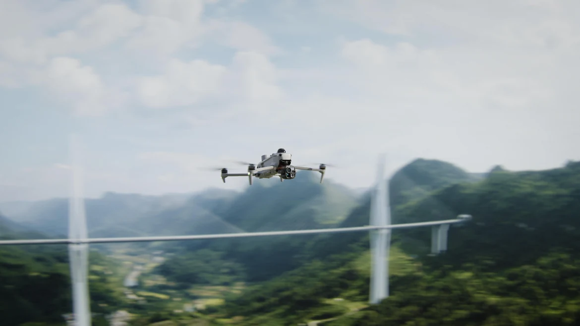
A compact enterprise aircraft combining LiDAR, mmWave radar and vision sensing with IP55 protection. Native 1K thermal imaging and enhanced night vision support observation by day and night; up to 59 minutes of flight time and multiple relay modes extend mission options. Onboard AI and Pilot 2 plugins support emergency response, inspections and surveying.[1][2][3][4]
Thermal imaging and night vision
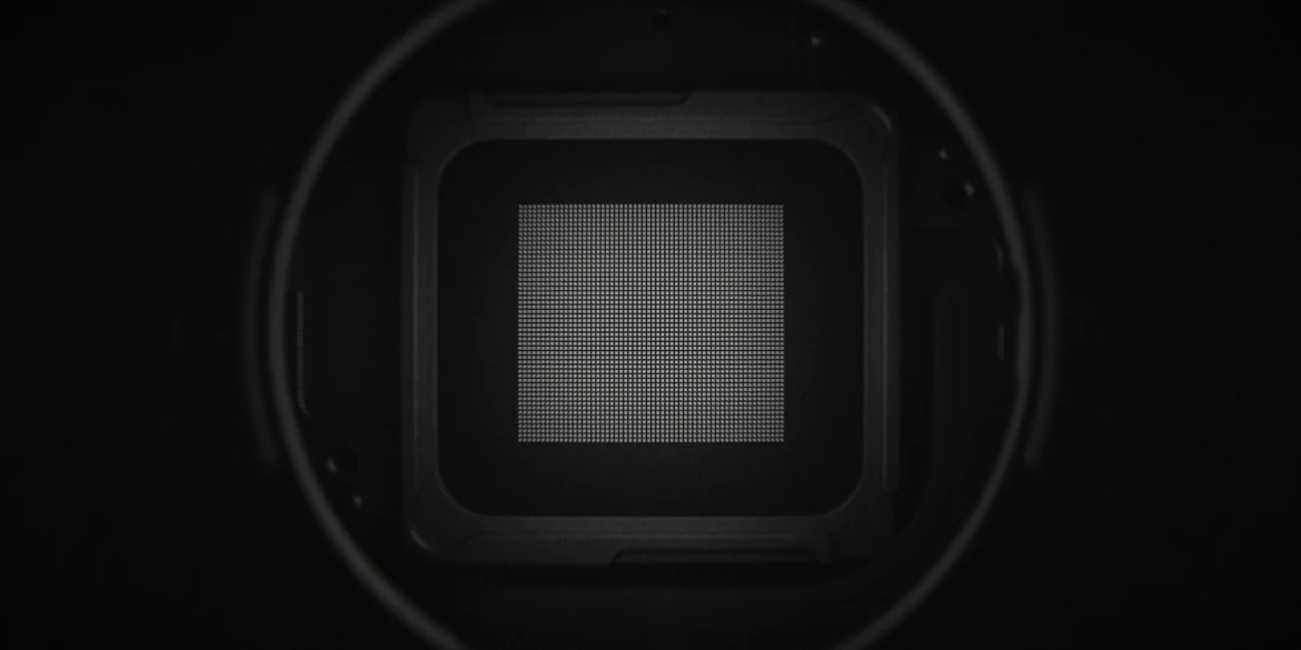
Native 1K thermal imaging
The 1280 × 1024 thermal sensor has four times as many pixels as a 640 × 512 sensor. UHR Infrared Image raises the real-time output to 2560 × 2048 at 30 fps, helping distinguish heat anomalies in visually complex scenes. Protect the thermal lens from intense energy sources.[6]
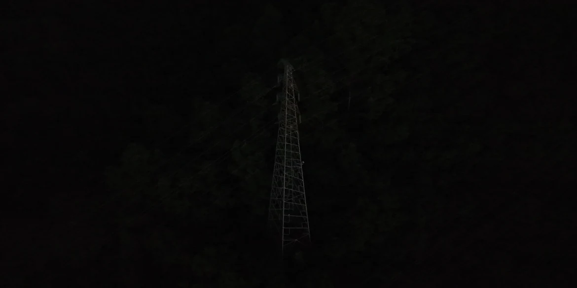
Wide-angle camera: colour after dark
The 1/0.98-inch sensor and f/1.8 lens combine with AI low-light processing. In Night Scene mode, ISO reaches 1,600,000; DJI specifies full-colour observation down to 0.01 lux under its test conditions.[7]
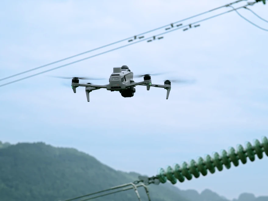
Medium telephoto: 50 MP and 3× optical zoom
A 50 MP camera with 3× optical zoom supports medium-distance inspection. DJI demonstrates identifying pins and cracks from 10 m during bridge and power-line inspections, as well as reading instruments in substations.[8]
Telephoto: long reach and monochrome night vision
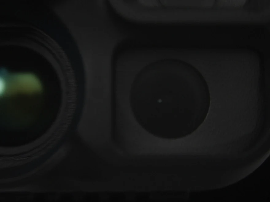
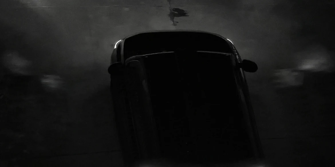
The 50 MP telephoto camera provides 11× optical and up to 176× hybrid zoom. DJI demonstrates reading vehicle plates from up to 400 m when facing the target directly.[9] Its RYYB colour filter array improves light sensitivity per unit area compared with RGGB. Adjustment of the IR-cut filter supports operation at lower light levels.
Ranging and viewing tools
Laser rangefinder
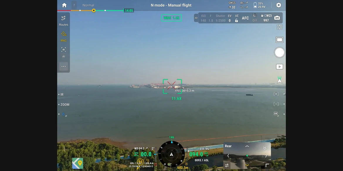
Measure distances up to 3 km under the specified conditions. Pinpoints, lines and area measurements help mark infrastructure or outline a wildfire perimeter.[10]
NIR auxiliary illumination
The near-infrared illuminator supports the telephoto camera’s monochrome night view, with effective illumination up to 100 m in DJI’s test. It is intended for the telephoto camera.[11][12]
Thermal and visible image fusion
Combine thermal and visible imagery on the controller to see temperature measurements and alarms within the visible view. A dial adjusts the blend. Split-screen layouts can show up to three feeds selected from wide-angle, telephoto, thermal, map and Vision Assist views.
Omnidirectional sensing and IP55 protection
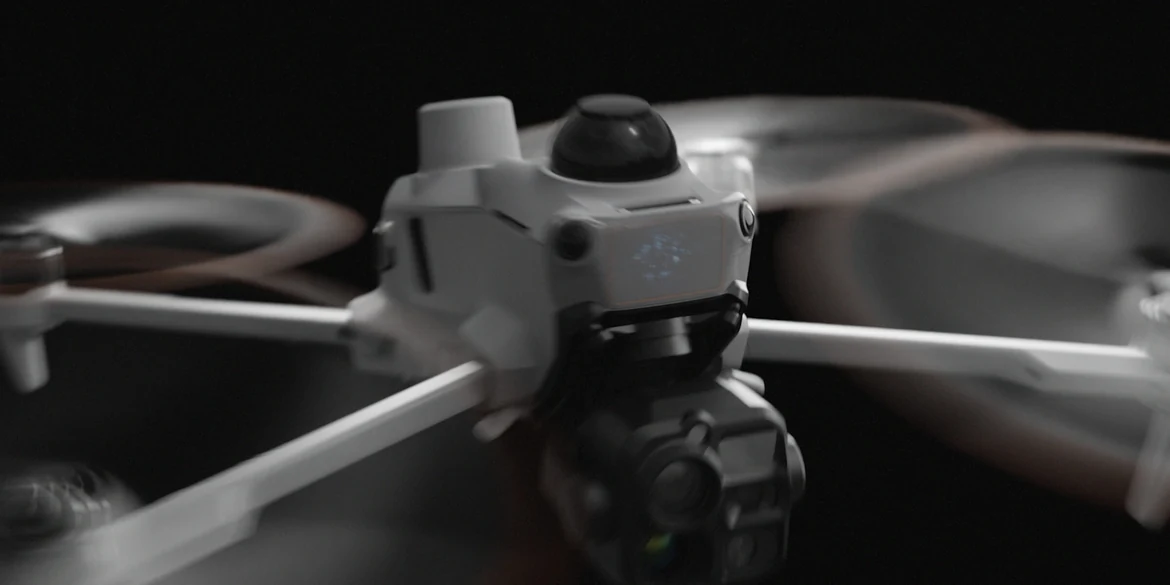
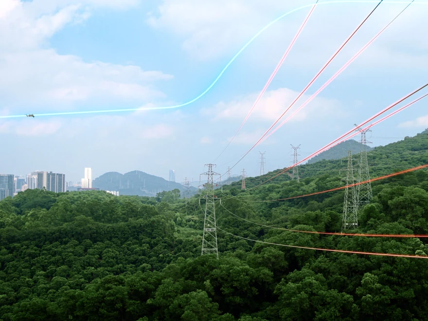
Detecting thin obstacles and wires
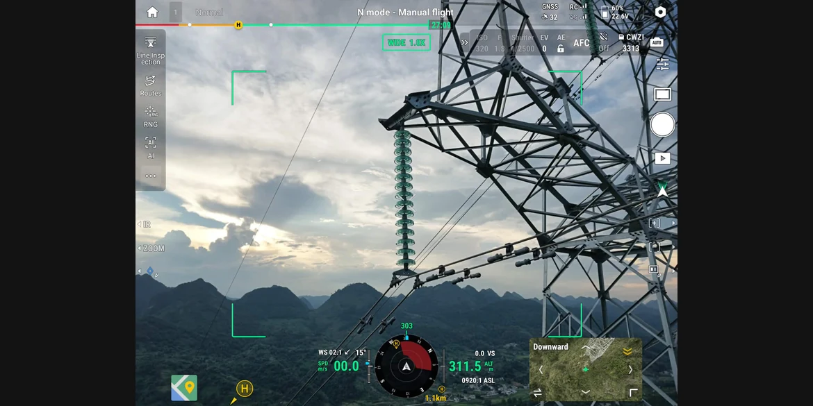
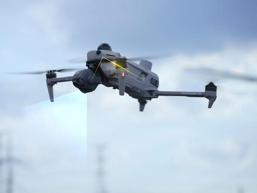
LiDAR, mmWave radar and omnidirectional vision operate together. LiDAR helps detect thin obstacles at night and can detect power lines at up to 32 m under DJI’s test conditions. Radar contributes to sensing in fog, rain and dust. Wire-detection speeds and regional radar restrictions are detailed in the notes.[13][14]
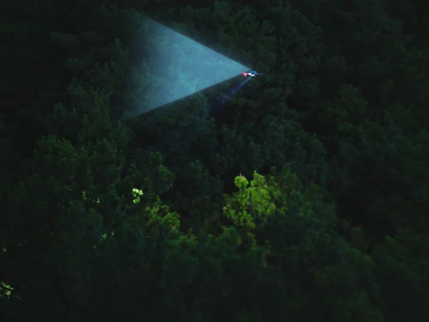
Low-light positioning and Vision Assist
Fisheye vision sensors support visual positioning down to 0.5 lux and colour imagery in Vision Assist. Vision and LiDAR work together in dim urban conditions; in unlit areas, LiDAR senses obstacles ahead. Vision sensors switch to monochrome below 12 lux, and textureless surfaces or illumination below 0.5 lux limit visual sensing.[15][16]
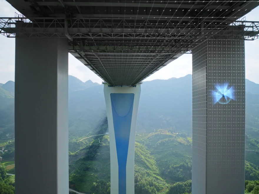
Operation where GNSS is weak
Visual and radar information is combined to map the surroundings in real time and support positioning beneath bridges, in deep canyons and between tall buildings. Water, reflections, insufficient texture and changing scenes require particular care.[17]
Awareness of surrounding air traffic
Integrated ADS-B and RID receivers detect nearby crewed and uncrewed aircraft and issue alerts. These warnings assist the pilot in maintaining separation during busy-airspace and multi-drone operations.
Onboard AI and cloud intelligence
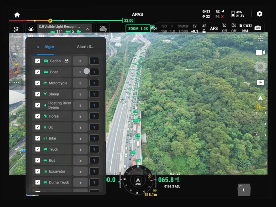
More than 20 detection categories
Built-in models identify more than 20 target types, including vehicles, vessels and fires. Thermal and visible feeds can be analyzed in parallel in split-screen view. Third-party algorithms can be deployed through the open onboard computing platform. Fire detection is limited to the visible-light view.[18]
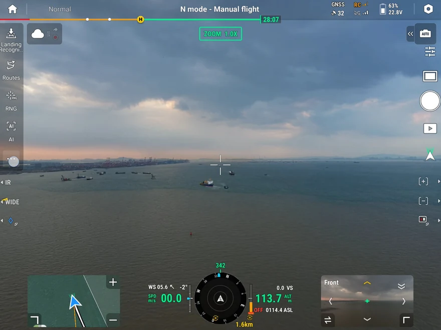
FlightHub 2: search with text or images
Connecting DJI Pilot 2 to FlightHub 2 enables cloud-based target searching from text or image prompts. A multimodal large language model interprets the request, detects matching objects and generates alerts.
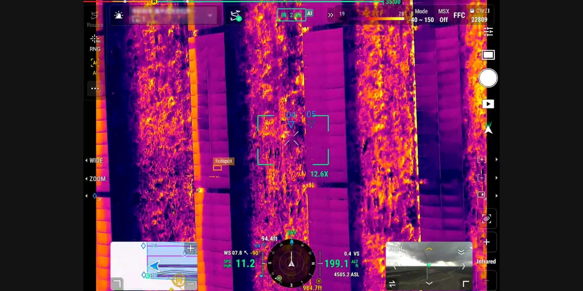
Automated AI patrol routes
Outline an area on the map to generate a patrol route. Configure actions such as hovering, photo capture, video recording or audio broadcasts when targets are detected. Results are compiled into reports after the flight.
O4 Enterprise Enhanced and relay operations
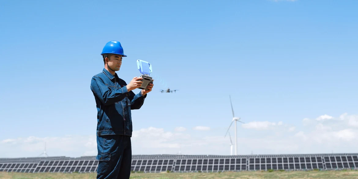
Transmission and cellular connectivity
O4 Enterprise Enhanced combines sub-2 GHz capability, where permitted, with a high-gain smart controller antenna array and adaptive frequency selection. The maximum stated range is 20 km under CE in Europe and 40 km under IC, measured without obstacles or interference on one-way, non-return flights.[19][20][21] Two built-in DJI Cellular Dongle 2 modules allow automatic selection of the best available network link; cellular coverage is required.[22]
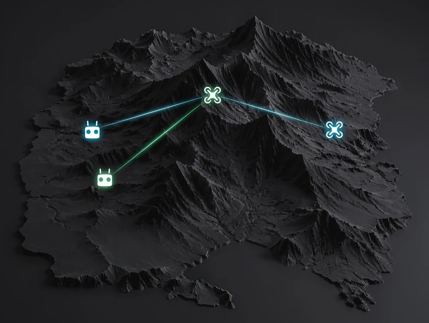
One relay, two controllers
One relay aircraft extends the communications link for one aircraft carrying out the mission. Relay functions require local support for the 5 GHz band.[4]
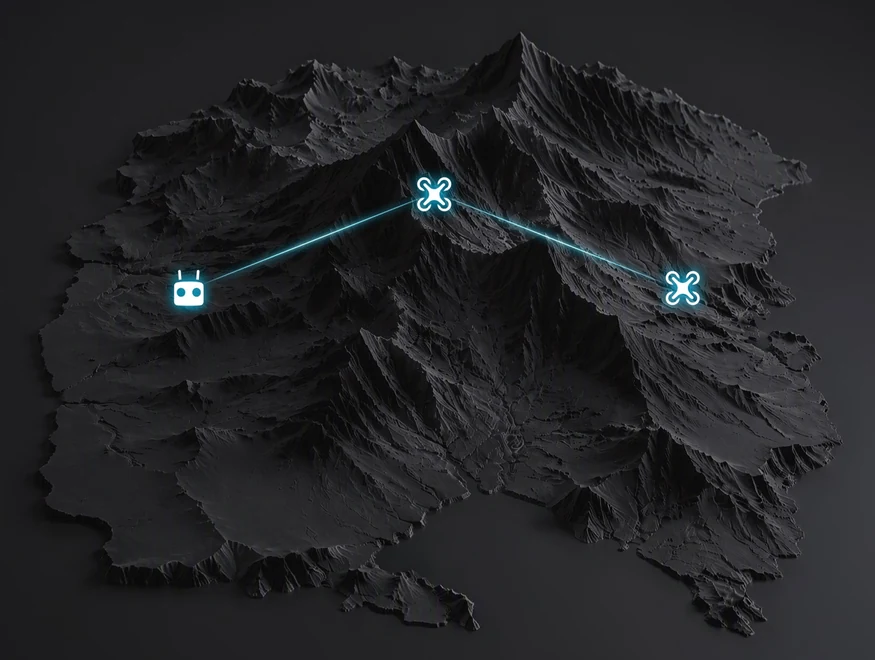
One relay, one controller
One controller manages both the relay and mission aircraft. The relay adjusts its attitude and hovering position to optimize the link.[4]
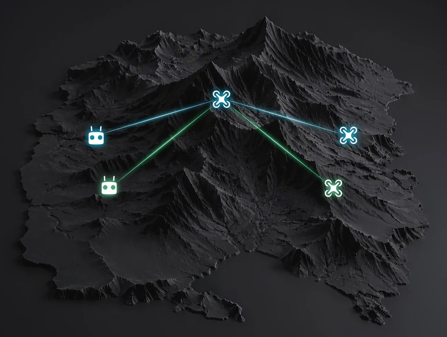
One relay, two controllers, three aircraft
A relay aircraft simultaneously carries data for two mission aircraft, supporting coordinated operations over a large area.[4]
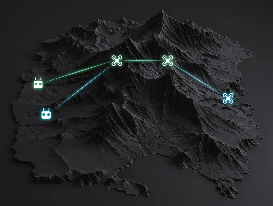
Two relays, two controllers
Two relay aircraft pass data sequentially to the mission aircraft, extending the communications path further.[4]
Propulsion and endurance
Up to 59 minutes in flight
A 215 Wh battery supports a maximum flight time of 59 minutes under DJI’s stated conditions. Longer endurance can reduce battery changes and relocations during field operations.[3]
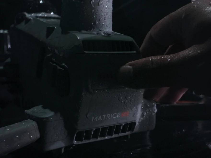
Low-noise propellers included
The standard propellers use swept tips inspired by bat wings to control airflow and vortices. DJI reports noise as low as 80 dB(A) under the specified measurement method, alongside improved aerodynamic efficiency.[23]
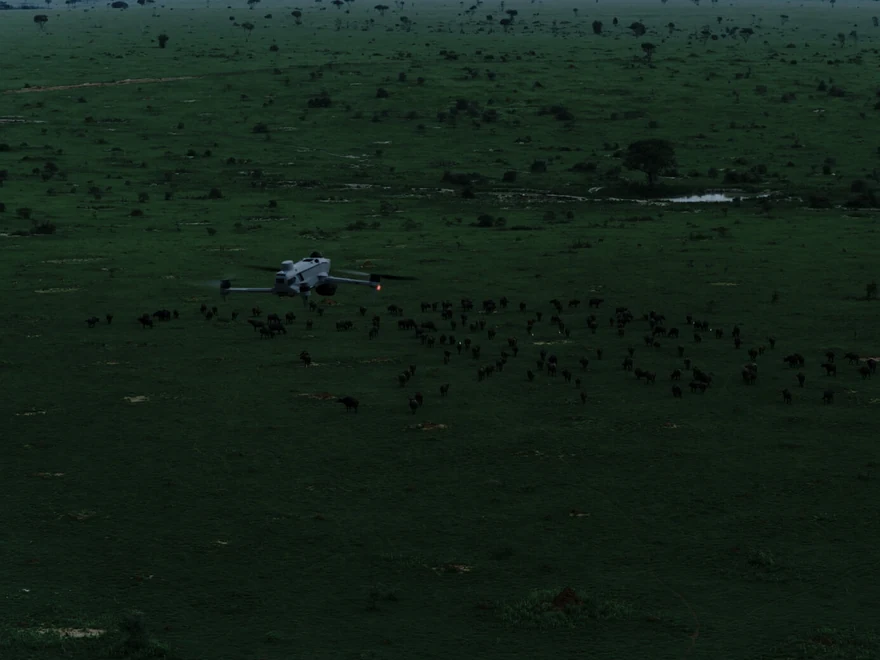
23 m/s maximum speed and rapid deployment
DJI specifies a maximum flight speed of 23 m/s and power-on to takeoff in 10 seconds, enabling rapid arrival and transmission of live information during emergencies.[24]
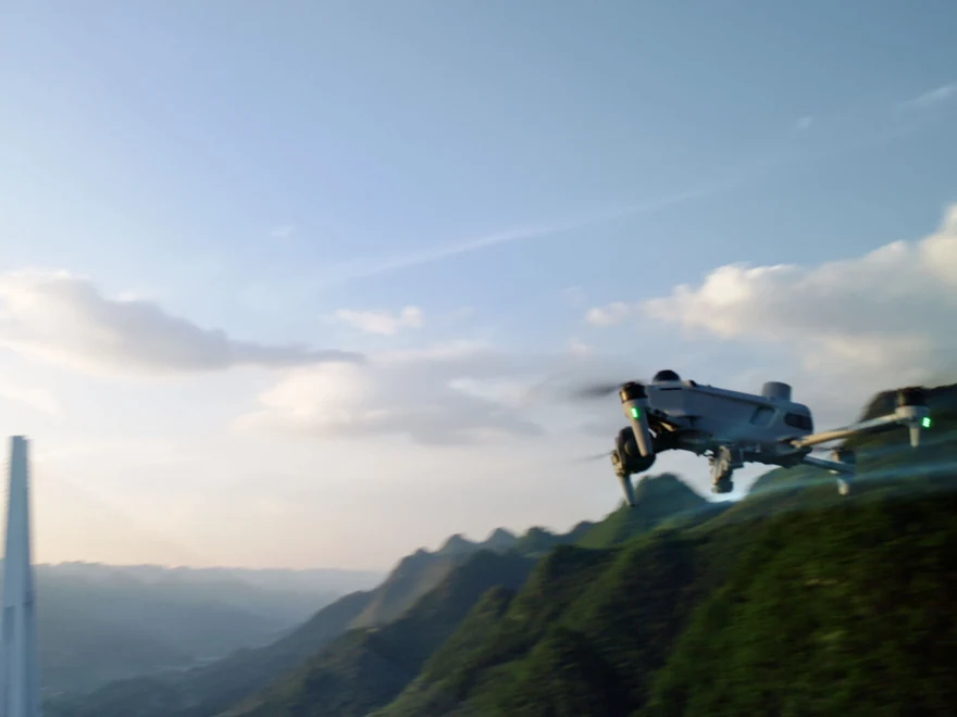
Propulsion redundancy
Bench testing shows 98% higher single-axis thrust than Matrice 4T. A phase-loss detection algorithm reacts within milliseconds; an affected arm can retain 50% of its maximum thrust to support hovering and landing. These are propulsion test figures, not payload ratings.[25]
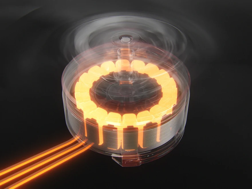
Surveying and on-site reconstruction
Centimetre-level surveying without GCPs
With DJI Terra, Matrice 5T supports centimetre-level surveying without ground control points under the stated acquisition conditions. This adds aerial mapping to its inspection capabilities.[26]
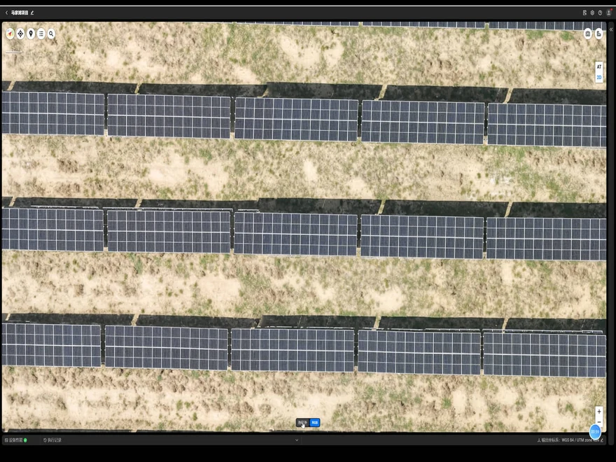
2D thermal orthomosaics
DJI Terra uses visible-image positioning as the reference when stitching thermal imagery. The resulting 2D thermal orthomosaics support temperature readings and anomaly marking for solar facilities and electrical networks.
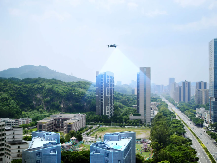
Local point clouds and 2.5D models
Images arrive at the controller during flight for local point-cloud or 2.5D reconstruction. Operators can annotate and measure directly on 2.5D models.[27] DJI reports processing 200 photographs in 8 minutes under its defined link conditions.[28]
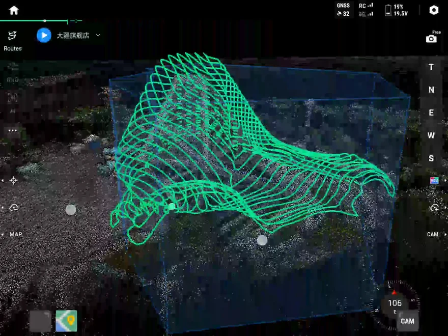
Smart 3D Capture
Create an approximate model on the controller, then generate detailed routes that follow the subject’s surface. Virtual routes and waypoint photographs help assess coverage and flight safety before completing the detailed capture.
Specialist missions and Pilot 2 extensions
Foreground stabilization
AI foreground segmentation separates the target from its background during telephoto observation, reducing background interference and helping retain clear subject detail.
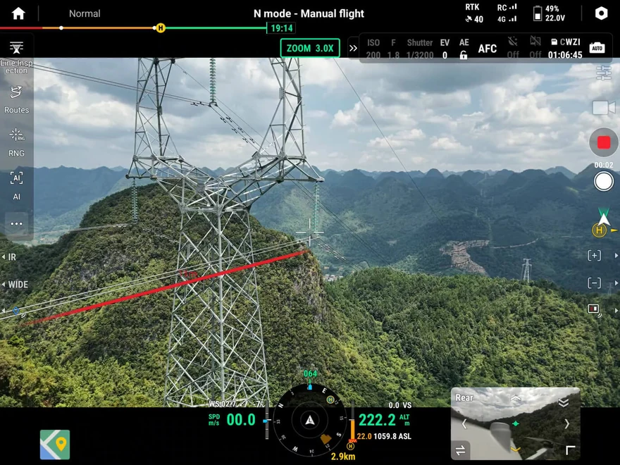
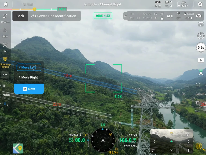
Following power lines
The top-mounted LiDAR detects and locks onto power conductors and ground wires. The aircraft can then fly laterally along the line to inspect issues such as broken strands or hanging foreign objects. Supported conductor configurations and slope limits are specified in note 29.[29]
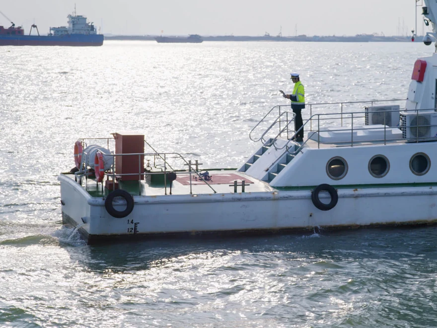
Takeoff and landing on a vessel
For maritime patrol and inspection, the aircraft supports takeoff from a moving vessel. It recognizes a designated deck landing pattern for return landing. DJI recommends vessel speed below 10 knots, wind below 5 m/s and a 3 × 3 m clear deck area.[30]
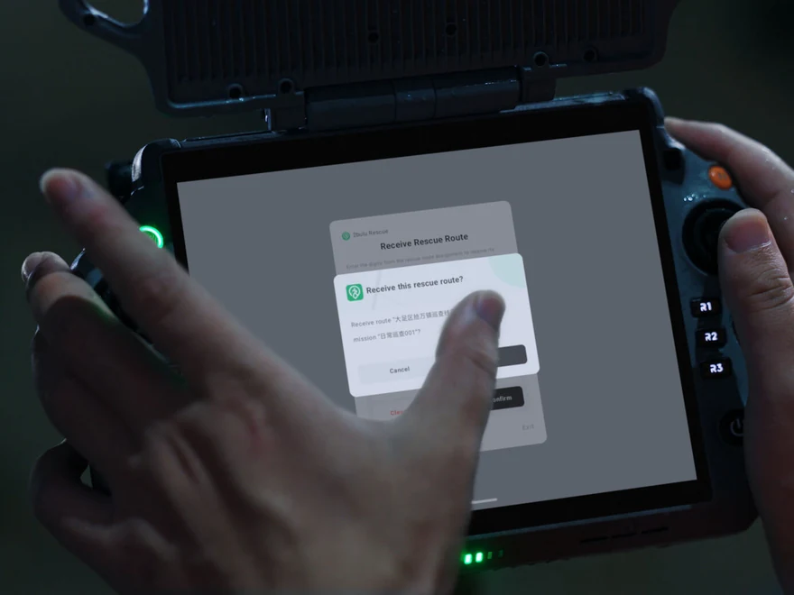
Custom Pilot 2 plugins
Developers can add capabilities as floating windows inside DJI Pilot 2. Reusing Pilot 2’s existing functions reduces the need to create a separate standalone application.
Software for professional workflows
DJI Pilot 2
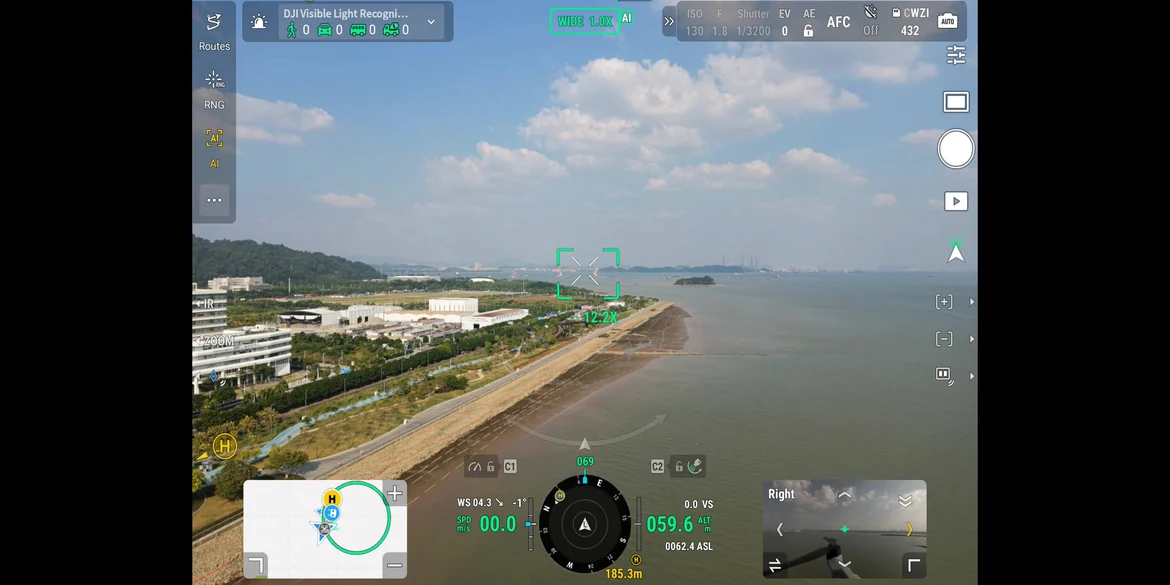
Cruise, FlyTo, Smart Track and POI automate flight tasks. Preset split-screen combinations show up to three views from wide-angle, telephoto, thermal, maps and Vision Assist. Arbitrary custom combinations are not supported. Plugins add third-party functions within the application.[31]
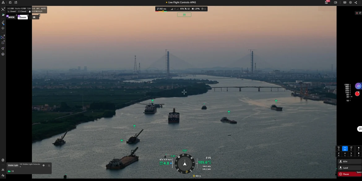
DJI FlightHub 2
Cloud functions include aircraft and gimbal control, remote takeoff and landing, FlyTo Task, Smart 3D Capture and geometric or slope route planning. Text/image-based multimodal target searches and simultaneous live feeds support coordination between multiple aircraft and ground teams.
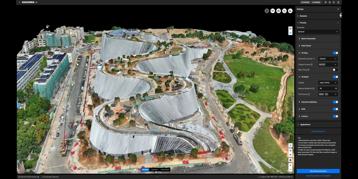
DJI Terra
Produce 2D maps, 3D reconstructions and point clouds for GIS, construction and emergency response. Offline visible-light PPK and D-RTK 3 data imports support accuracy without GCPs. Terra also supports 2D thermal mapping, rolling-shutter reconstruction and reconstruction from video frames.
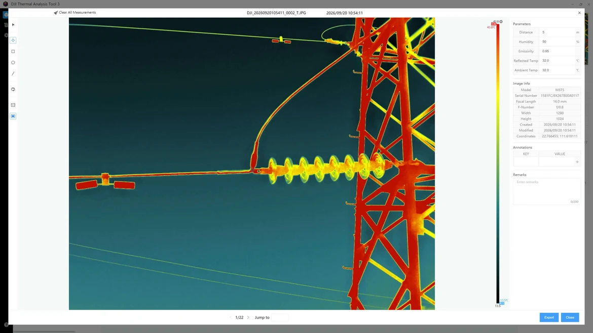
DTAT 3.0
Use DJI’s thermal analysis tool after the flight to annotate, process and analyze thermal photographs and identify abnormal temperature points.
Data protection
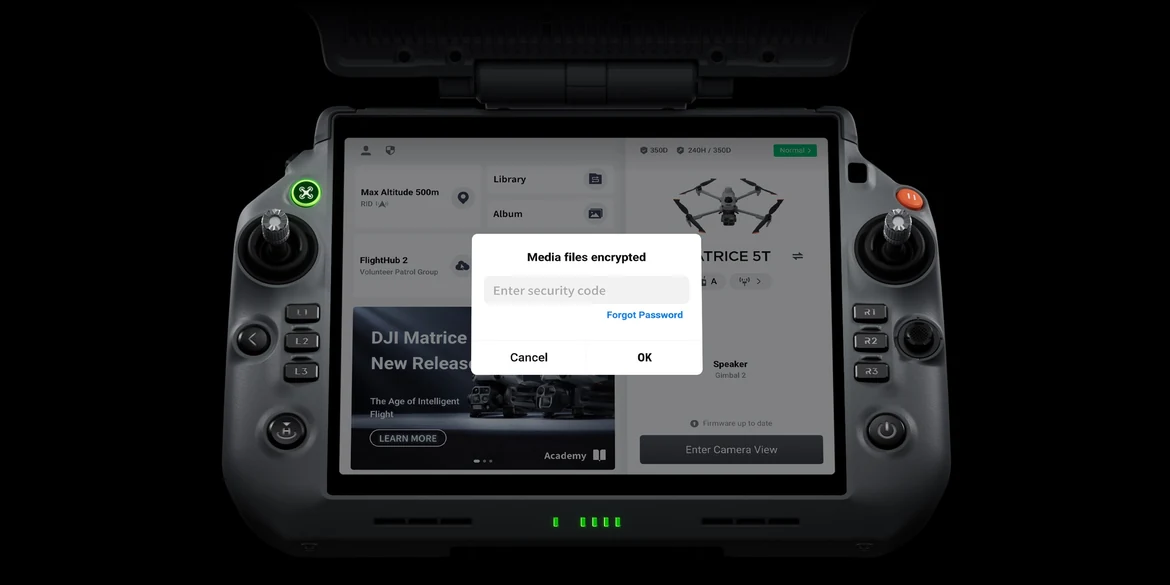
Security controls
The platform provides media-data encryption, Local Data Mode, one-tap log clearing and AES-256 encryption for video transmission. DJI data-security information ↗
Open development ecosystem
AI algorithm development
DJI provides model-training tools and a third-party developer certification process for access to onboard computing. AI developer resources ↗
Mobile SDK V5
Develop custom applications or plugins that use core DJI Pilot 2 functions. Open-source production-level code samples include core modules adapted from Pilot 2. MSDK ↗
Payload SDK and E-Port V3
E-Port V3 supports encrypted authentication of third-party payloads and protected data transmission for custom integrations. PSDK ↗
Cloud API
Pilot 2’s built-in MQTT-based Cloud API connects the aircraft to third-party cloud platforms. Access hardware capabilities, live video and photograph data without building a separate mobile application. Cloud API ↗
Service and support
DJI Care Enterprise Plus
DJI lists a complimentary first year of either DJI Care Enterprise Plus or Official Extended Warranty Service; availability and terms vary by country and region and must be confirmed for the supplied package.[32] Care Enterprise Plus includes unlimited repairs within the coverage scope and amount, eligible fleet-wide shared coverage, one flyaway claim per year, battery replacement, two-way shipping in covered regions and technical-expert support. Service starts with activation.
Official Extended Warranty Service
An additional year extends the standard warranty for covered main components, with professional engineering support and original replacement parts. Covered components include the aircraft body, gimbal camera, remote controller and charging hub. Regional service terms apply.[32]
Controller, charging and mission accessories
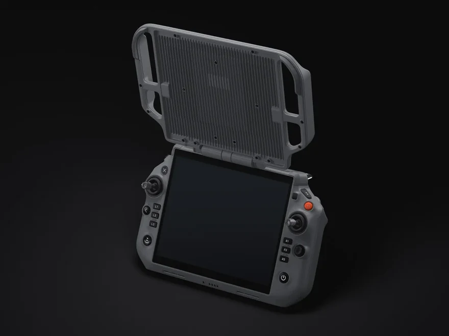
DJI RC Plus 3 Enterprise
The 7.44-inch display reaches 2,000 nits. A high-gain smart antenna array and DJI Cellular Dongle 2 are integrated, without external modules. DJI reports up to 6 hours of controller runtime under its test configuration.[A2] The carrying case is similar in size to the Matrice 4 Series case and can be carried in one hand.
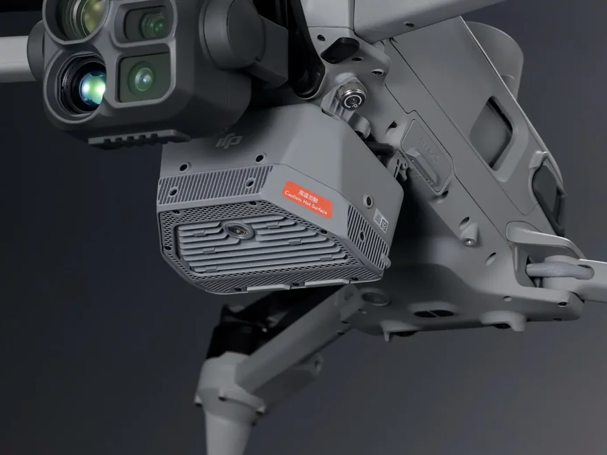
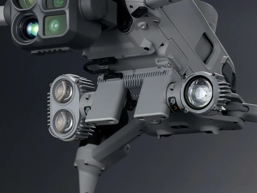
DJI AL2 SpotLight
Flood and spot lighting support continuous illumination and strobe modes. Centre illuminance reaches 10 lux at 100 m in Turbo mode under laboratory conditions. The light follows camera tilt from −90° to 90° for night searches and under-bridge inspection. Its operation can affect vision sensing. Sold separately.[A1][A4][A5]
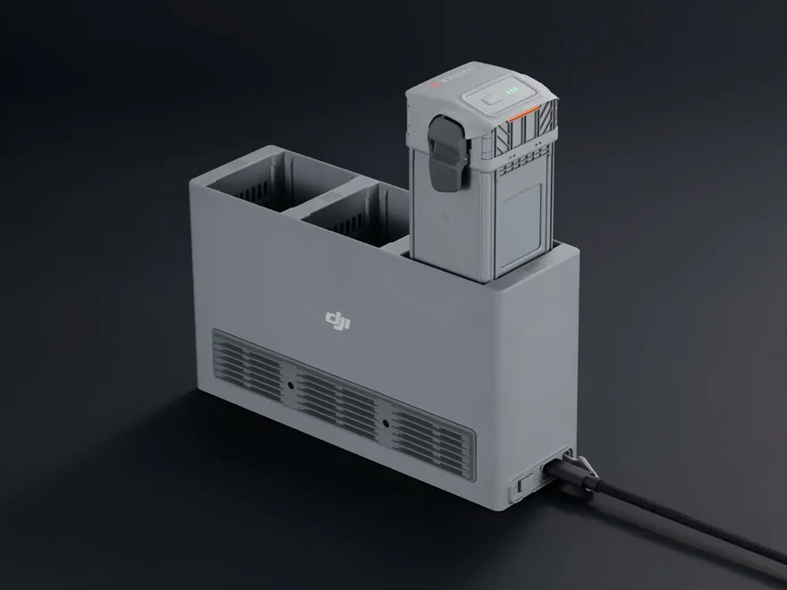
Matrice 5 Series Charging Hub
The hub provides up to 515 W and has a cooling fan. In Standby mode, DJI specifies charging from 10% to 95% in 31 minutes at 25 °C. It supports simultaneous fast charging of batteries and the controller. Temperature and battery condition affect charging performance.[A6][A7]
Application areas
A platform for varied field operations
DJI presents Matrice 5T for public safety, power-line inspection, geographic information, oil and gas, renewable energy, water-resource management, building inspection, roads and bridges. Select sensors, software and optional payloads according to the mission.
Key specifications
| Takeoff weight | 2,239 g including battery, propellers and microSD card; maximum 2,639 g |
|---|---|
| Dimensions, excluding propellers | Folded: 335 × 155 × 203 mm Unfolded: 408 × 507 × 191 mm |
| Flight / hovering time | Up to 59 / 54 minutes, without wind[3] |
| Speed / wind resistance | Up to 23 m/s forward (Sport mode, sea level, no wind) / 12 m/s during takeoff and landing |
| Wide / medium telephoto / telephoto | 50 MP each; equivalent focal lengths 23.5 / 70 / 252 mm |
| Thermal camera | 1280 × 1024, 30 Hz, f/0.85 lens; UHR: 2560 × 2048 |
| Temperature measurement ranges | High Gain: −20 to 150 °C Low Gain: 0 to 550 °C |
| RTK accuracy (RTK Fix) | Horizontal: 1 cm + 1 ppm Vertical: 1.5 cm + 1 ppm |
| Battery | 10,073 mAh · 215.2 Wh · Li-ion 6S |
Official DJI resources
Test conditions, operating limitations and service notes
DJI’s figures come from production-aircraft tests in controlled environments. Actual performance varies with environment, use and firmware. Product demonstrations were made under local rules and from safe distances; verify applicable laws, permits and qualifications before flight.
- Consult the user manual for vision-system operating conditions. Positioning and obstacle sensing depend on the environment and obstacle characteristics; maintain cautious pilot control.
- IP55 was measured in a controlled environment. Follow the IP55 operating instructions. Protection is not permanent and may decline through wear.
- Flight time: controlled wind-tunnel conditions equivalent to sea level without wind; forward flight at approximately 9 m/s, no payload, ending at 0% battery. Actual time varies with flight mode, accessories and environment. Follow app battery reminders.
- Relay functions are unavailable in countries or regions without 5 GHz support. Local regulations apply.
- DJI lists the accessories separately. Confirm the exact package contents and optional equipment in your quotation.
- Never expose the thermal camera lens to the sun, lava, lasers or other intense energy sources: permanent sensor damage may result.
- 0.01 lux observation was tested with Night Scene mode and maximum ISO 1,600,000. Visibility, surface reflectivity and light pollution affect results.
- The medium-telephoto demonstration used standard illumination and a horizontal, unobstructed view from 10 m.
- The telephoto plate-reading demonstration was captured with the camera directly facing the subject.
- Maximum ranging test: 25 °C, visibility above 8 km, target reflectivity above 25% at 905 nm, with the beam perpendicular to the target surface.
- The NIR auxiliary light is designed for the telephoto camera.
- NIR illumination was tested with the aircraft hovering 100 m above ground and effective image capture by the telephoto camera.
- Facing a 21.6 mm steel-core aluminium transmission conductor directly, sensing is supported up to 21 m/s; for a 12 mm distribution conductor, up to 15 m/s. Weather, obstacle material, shape and position affect detection. Fast-moving objects cannot be actively avoided. mmWave radar may be restricted or unavailable locally. Consult the manual.
- 32 m wire detection was measured with a 21.6 mm steel-core aluminium conductor within LiDAR field of view, in sunny conditions with good lighting but no direct sunlight; illuminance below 35,000 lux.
- Urban-night visual sensing was assessed without spotlight or speaker fitted. Vision cannot detect textureless surfaces or operate below 0.5 lux as specified. Refer to the manual.
- Vision sensors change to black-and-white below 12 lux.
- Vision may not function properly over water. Maintain aircraft control, adequate lighting and clearly textured surfaces below. Avoid reflections and dynamically changing environments.
- Fire detection is available only in the visible-light camera view.
- Sub-2 GHz functionality is unavailable in some countries and regions. Check local rules.
- Maximum communication range: IC 40 km; CE Europe, SRRC Mainland China and MIC Japan 20 km. Tested without obstructions or interference, on one-way flights without return. These figures are not an operational radius. Observe DJI Pilot 2 return-to-home reminders.
- Permitted operating frequencies depend on country and region.
- Cellular transmission requires mobile-network coverage.
- Noise was measured under GB 42590-2023 at a distance of 4.5 m, using a ground measurement height of 0.5 m and side measurement height of 5 m. Environment, payload and flight conditions affect actual noise.
- Maximum speed was tested in a controlled wind tunnel equivalent to windless sea-level conditions.
- Single-axis maximum thrust was compared with Matrice 4T on a test bench under identical laboratory conditions equivalent to windless sea level, at the battery platform voltage. Actual payload capacity depends on configuration, attitude and environment; refer to the official specifications.
- Surveying accuracy was measured on Area Route Ortho or Oblique missions at 120 m, with 12 MP images and without Terrain Follow.
- 2.5D model test acquisition: altitude 100 m, speed 15 m/s, 80% forward and 70% side overlap.
- The 200-photo processing test used interference below −90 dBm and an aircraft within 500 m of the controller. Time is measured from completion of image capture to final output.
- In windless conditions, line inspection supports single-, twin-, four-, six- and eight-bundle conductors and ground wires, at inclinations below 40°.
- Recommended vessel-operation conditions: speed below 10 knots, wind below 5 m/s, and a 3 × 3 m takeoff/landing area. Exercise caution outside these conditions. Standard deck landing patterns are available in DJI Downloads.
- Split screen supports a maximum of three simultaneous feeds in preset combinations; custom combinations are not supported.
- Services differ by country/region. Free repairs remain within the coverage scope and amount. Shared coverage applies to eligible DJI Enterprise products activated and bound to Care Enterprise Plus within the same 30-calendar-day period. Flyaway cover requires account linking and controller binding in Pilot 2. Two-way shipping applies only within covered regions; out-of-scope logistics and customs are payable by the user. Extended warranty covers the aircraft body, gimbal camera, controller and charging hub. Confirm local terms with ATTEX.
- A1. AS2 Speaker and AL2 SpotLight are sold separately.
- A2. Controller runtime was tested during close-range indoor hovering: maximum brightness; Wi-Fi, Bluetooth, screen recording, AR Street, 4G Enhanced Transmission and cloud streaming enabled; wide-angle plus thermal view. Actual runtime varies with settings and conditions.
- A3. Speaker results were measured at 25 °C in an experimental environment. Software, source audio and surroundings affect performance.
- A4. Spotlight illuminance was measured in Turbo mode at 25 °C in a laboratory.
- A5. AL2 operation can affect the vision system; fly cautiously.
- A6. Ambient temperature can affect charging power; overheating can cause power throttling.
- A7. Charging time was measured at 25 °C. Higher or lower temperatures and battery condition can lengthen charging.
Request an offer for DJI Matrice 5T
Complete the form below and an ATTEX representative will contact you about the right configuration for your application.